Written by Aaron Murphy, PLS
There has been a lot of attention given to the advantages and efficiency of utilizing Unoccupied Aerial Vehicles (UAVs or drones) for survey data collection recently. The workflows peddled by salespeople sound amazing. Charge some batteries, input a flight path, push start, and let the UAV do the rest. Then download the data, run it through some software, and the AI spits out your finished project. Super easy and no need for a surveyor, right? If only that were true. This simplified workflow may help get a quick estimate of the volume of a stockpile of dirt, but it probably won’t work for your next land development project for a variety of reasons. While UAVs represent a significant advancement in how some survey data is collected, they are still only one of many tools in the surveyor’s tool kit. Understanding where the hype leaves off and the ground-truthing begins is imperative to making sure you capture the correct services under contract so that the survey data delivered works for your project.
First, the weather can be a significant determinant in deploying a UAV. High winds, cold temperatures, and moisture all can affect the ability to collect data from the air. The danger of crashing a drone in high winds may seem obvious, but even in light wind conditions helicopter-type UAVs will run through batteries as they try to stay on the prescribed flight path. Cold temperatures can reduce battery life significantly – or not operate at all. Rain and snow can affect the operation of the UAV, and render it useless if the sensitive electronics of the vehicle or data collection device are exposed to moisture.
Another factor to consider is air clearance. Many areas, including airports, sports and concert venues, and detention centers have air clearance restrictions. This must be determined before-hand since the UAV may not be able to fly over a given project at all. In some instances, limited air clearance may be granted, but the authorization process could take weeks or more. Depending on the location, a surveyor with boots on the ground may be the best and quickest option to collect survey information.
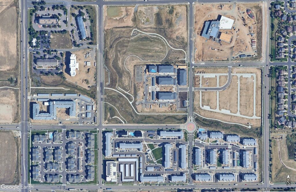
We also need to consider the payload on the UAV and what type of data is to be collected. There are a number of cameras, sensors, and LiDAR (laser scanning) payloads that can be attached to most commercial UAVs. Pictures from a camera can be processed into orthorectified (perspectiveless) imagery of a site, which is useful for visualization purposes. Those images can also be run through photogrammetric processes to generate topography. The limitation of this method is that the topography produced does not necessarily get to bare earth. Trees, vegetation, canopies, awnings, and similar items are a part of the resultant surface. Similarly, culverts and underpasses may not be visible in the imagery, so that data does not get into the surface either. Traditional survey equipment and methods may still be necessary to get through, into, and under these obscured areas.
Using a LiDAR scanner has the advantage of being able to penetrate vegetation. However, it does not collect imagery. The project may need to be flown twice, first to collect photos and then again to collect the LiDAR point cloud. Both imagery and LiDAR methods are very limited in the data that can be generated when there is significant amounts of snow or ice on a site. Overlapping images cannot be properly correlated in large swaths of uniform white areas. LiDAR signals are scattered by surface water, snow, and ice, so no data is returned to the LiDAR unit in order to generate a point cloud of data points.
Once imagery or LiDAR data has been collected, it needs to be processed into usable data formats. While most of this is done by software, there are some key considerations critical to ensuring a complete and accurate data set. The first consideration relates to the overall accuracy of the data collected. To ensure the data is accurate, some level of ground-truthing should take place. Ground control points and check points are key components in controlling and verifying the overall accuracy of the data and resultant model. Most often, this will require survey-grade equipment and personnel to establish and/or locate easily identifiable points with accurate coordinate values. This process is not much different from panel points used in traditional photogrammetry for decades. Although the UAV and the software can collect and process data without known coordinates, the accuracy of the data is unknown and very likely does not meet the stringent accuracy standards necessary for design surveys.
Even after the data is collected, there is still a lot of work to do to get to a deliverable that will be useful to an engineer. Most design professionals are not equipped to deal with the very large file sizes of point clouds and image tiles. Further, the point cloud and imagery are not discrete, vector-based planimetric objects that are a standard part of most survey deliverables. Skilled technicians and training on UAV-specific software are often necessary to extract usable features from the raw data sets. Sorting through that data and extracting the relevant and desired elements is time consuming – sometimes taking longer than a field surveyor would have taken to collect it in the field. Verification of some items will require boots on the ground regardless. What may look like a fiber optic access may in fact be a discarded pizza box. Manholes may be identifiable as such, but the UAV cannot determine if it is a storm sewer or sanitary sewer manhole. Especially with regard to utility structures, a set of eyes in the field is still necessary to identify the specific function of most facilities.
Finally, although the UAV collected thousands of images and millions (or billions) of points in the point cloud, the UAV survey is still lacking what designers often need most – boundary and right-of-way lines. A map created from a robust, feature-rich data set can be all but useless if it cannot be related to the right-of-way line of the adjoining highway, or the boundary line of the unsupportive neighbor. Boundary evidence is recovered on the ground in the work to recover survey monuments, which are usually recessed in boxes in streets, under vegetation, or covered by dirt and landscaping at property corners. In addition to a set of technologically sophisticated tools, boundary monument recovery often involves the use of simpler tools like pry bars and shovels. No amount of laser scanning or photos can uncover the evidence necessary for a surveyor to form an informed, professional opinion about the location of the right-of-way and boundary lines that make up very important constraints to almost every development project.
UAVs are an exciting and important part of the development of survey data collection but in no way replace the need for an experienced, knowledgeable survey team. We are great partners for your next development project with experience ranging from dense multi-family infill to large master-planned communities. We navigate a balanced approach that integrates traditional surveying methods with modern technology, ensuring that the survey data we collect aligns with the precision and accuracy required for your projects. We have the expertise to thoughtfully utilize technology, from LiDAR to UAVs, that will meet the unique demand of your next successful project.


